Our River
The Upper Etowah River watershed is a beloved treasure of immense cultural, historical, economic, social, and environmental significance.
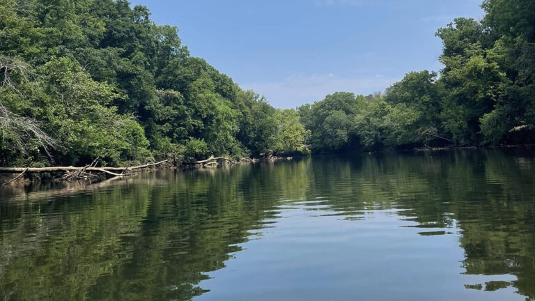
The Upper Etowah River watershed is a beloved treasure of immense cultural, historical, economic, social, and environmental significance.
We head to these waters to kayak, fly-fish for native bass and trout, hike mountain trails, and find peace in nature. In addition, wildlife and North Georgia communities depend on the river’s natural resources to thrive.
The river also holds deep historical and sacred importance for the Cherokee people. For generations, it served as a vital artery for life, trade, and community. Downstream, the Etowah Mounds near Cartersville mark a riverside town settled by the twelfth century.
Today, local farmers, poultry producers, and orchardists still rely on the watershed. Meanwhile, the river provides clean drinking water and hydroelectric power to hundreds of thousands of North Georgia residents.
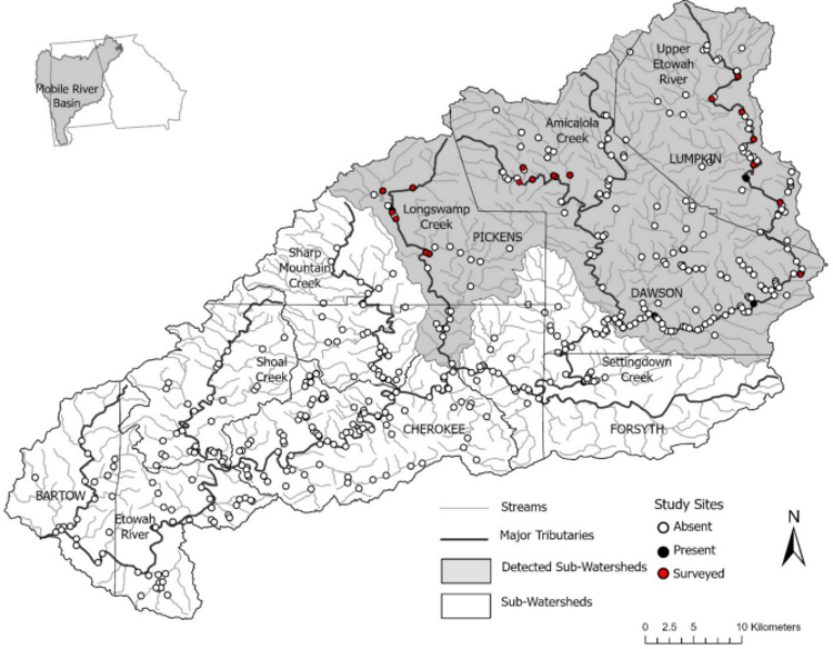
The Upper Etowah River watershed sits in north Georgia, just above Atlanta. It spans parts of five counties: Lumpkin, Dawson, Pickens, Forsyth, and Cherokee.
More than 100 tributaries feed it, including Shoal, Amicalola, Yellow, Setting Down, Long Swamp, and Sharp Mountain creeks. The river begins in the mountains near Dahlonega and then runs 98 miles to Lake Allatoona.
However, this is only a fraction of the entire Etowah Basin, which drains about 1,858 square miles. In turn, the Etowah feeds the Coosa River basin. From there, water flows through the Mobile River basin to the Gulf of Mexico.
The Etowah River watershed is one of north Georgia’s most biodiverse ecological treasures. In fact, it is home to rare aquatic species found nowhere else on Earth, such as the endangered Etowah darter. As a result, the region is especially vulnerable to environmental pressures.
From the Blue Ridge headwaters to the foothills, the watershed’s chemical, physical, and biological health faces serious threats, including:
Although conservation efforts have made real progress, many streams in the Upper Etowah still struggle to meet state water-quality standards. Consequently, sedimentation and habitat loss remain ongoing risks to native darters, mussels, and other sensitive wildlife.
Local and state agencies also struggle to monitor the watershed as often as it needs. On top of that, human activities disrupt the basin’s natural hydrology, including:
Together, these factors alter natural stream flows and seasonal patterns, which stresses sensitive aquatic species. Moreover, cycles of prolonged drought and heavy rain increase erosion and threaten the river’s long-term health.
Join our community of members who are committed to protecting the Etowah River.
Join us on the water and along the shore through hands-on volunteer opportunities that directly protect and restore our local watershed.
If you see something, say something. Let us know if you see a possible water quality problem.
Sign up to our newsletter and receive our emails, event information, and updates.
Think of a watershed like a bowl. The Etowah River runs along the bottom of the bowl, while the surrounding high points of land form the sides. Rain or snow falling on these high points drains down through various tributaries into the river, meaning everything that happens within that “bowl” directly affects the quality of the water.
The Upper Etowah River Watershed encompasses 610 square miles, which equals 390,400 acres.
The upper watershed is only a fraction of the wider Etowah Basin, which spans a total drainage area of approximately 1,858 square miles and includes all 150 miles of the river.
There are over 100 tributaries in the upper watershed, including major streams like Shoal, Amicalola, Yellow, Setting Down, Long Swamp, and Sharp Mountain creeks.
The river begins its journey in the mountains near Dahlonega and flows for 98 miles until it reaches Lake Allatoona.
It includes parts of five counties in central north Georgia just above Atlanta: Lumpkin, Pickens, Dawson, Forsyth, and Cherokee.
The Etowah River watershed is biologically one of the richest river systems in the entire world, housing 76 native fish species.
Yes. Biological inventories show that 15 native fish species have already been lost since the first records were taken in the late 1800s.