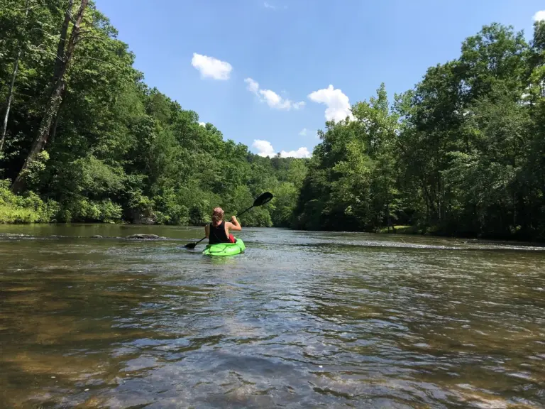
Etowah River in Dahlonega, GA. Photo from u/klaseter23 on Reddit.

Etowah River Water Trail

Paddle 163 miles of Georgia river, from the mountains near Dahlonega to downtown Rome, on the Etowah River Water Trail.
Explore the trail

The Etowah River Water Trail runs 163 miles through north Georgia, from Lumpkin County to Floyd County. It passes near Dahlonega, Dawsonville, Canton, Cartersville, Euharlee, and Rome. It’s a good first river for new paddlers and has plenty of history for anyone who likes to stop and look around. Explore the interactive water trail map below. 

The map needs JavaScript. Every launch is listed below.

Launches and take-outs as a list

From upstream (Dahlonega area) to downstream (Rome).
  1. Hightower Church Rd near Camp Wahsega Directions to Hightower Church Rd near Camp Wahsega (opens in a new tab)
  2. Hightower Church Rd at Miles Berry Rd Directions to Hightower Church Rd at Miles Berry Rd (opens in a new tab)
  3. Jay Bridge Rd Directions to Jay Bridge Rd (opens in a new tab)
  4. GA 52 Bridge Directions to GA 52 Bridge (opens in a new tab)
  5. GA 9 Bridge, Lumpkin County Directions to GA 9 Bridge, Lumpkin County (opens in a new tab)
  6. Castleberry Bridge Rd Directions to Castleberry Bridge Rd (opens in a new tab)
  7. GA 136 Bridge Directions to GA 136 Bridge (opens in a new tab)
  8. GA 53 Bridge (USGS gauge) Directions to GA 53 Bridge (USGS gauge) (opens in a new tab)
  9. Hugh Stowers Rd Directions to Hugh Stowers Rd (opens in a new tab)
  10. Dawson County River Park (GA 9) Learn more about Dawson County River Park (GA 9) (opens in a new tab) · Directions to Dawson County River Park (GA 9) (opens in a new tab)
  11. Kelly Bridge Rd (private, fee) Directions to Kelly Bridge Rd (private, fee) (opens in a new tab)
  12. Amicalola Creek at GA 53 Learn more about Amicalola Creek at GA 53 (opens in a new tab) · Directions to Amicalola Creek at GA 53 (opens in a new tab)
  13. Old Federal Rd Directions to Old Federal Rd (opens in a new tab)
  14. Eagle's Beak Park Learn more about Eagle's Beak Park (opens in a new tab) · Directions to Eagle's Beak Park (opens in a new tab)
  15. Yellow Creek Rd Directions to Yellow Creek Rd (opens in a new tab)
  16. McGraw Ford WMA Learn more about McGraw Ford WMA (opens in a new tab) · Directions to McGraw Ford WMA (opens in a new tab)
  17. Long Swamp Creek Recreation Area Learn more about Long Swamp Creek Recreation Area (opens in a new tab) · Directions to Long Swamp Creek Recreation Area (opens in a new tab)
  18. East Cherokee Dr (Gober Beach) Directions to East Cherokee Dr (Gober Beach) (opens in a new tab)
  19. Etowah River Park (approximate location) Learn more about Etowah River Park (opens in a new tab) · Directions to Etowah River Park (opens in a new tab)
  20. Boling Park (approximate location) Directions to Boling Park (opens in a new tab)
  21. Knox Bridge Ramp Learn more about Knox Bridge Ramp (opens in a new tab) · Directions to Knox Bridge Ramp (opens in a new tab)
  22. Allatoona Dam Ramp Directions to Allatoona Dam Ramp (opens in a new tab)
  23. Old River Rd near US 41 Directions to Old River Rd near US 41 (opens in a new tab)
  24. Sam Smith Park Learn more about Sam Smith Park (opens in a new tab) · Directions to Sam Smith Park (opens in a new tab)
  25. Leake Mounds Launch (GA 113) Learn more about Leake Mounds Launch (GA 113) (opens in a new tab) · Directions to Leake Mounds Launch (GA 113) (opens in a new tab)
  26. Floyd's Landing (Euharlee Rd, private) Learn more about Floyd's Landing (Euharlee Rd, private) (opens in a new tab) · Directions to Floyd's Landing (Euharlee Rd, private) (opens in a new tab)
  27. Euharlee Road Landing Learn more about Euharlee Road Landing (opens in a new tab) · Directions to Euharlee Road Landing (opens in a new tab)
  28. Hardin Bridge Learn more about Hardin Bridge (opens in a new tab) · Directions to Hardin Bridge (opens in a new tab)
  29. Neel's Landing (US 411) Learn more about Neel's Landing (US 411) (opens in a new tab) · Directions to Neel's Landing (US 411) (opens in a new tab)
  30. Dixon Landing at Grizzard Park (GA 1 Loop) Learn more about Dixon Landing at Grizzard Park (GA 1 Loop) (opens in a new tab) · Directions to Dixon Landing at Grizzard Park (GA 1 Loop) (opens in a new tab)
  31. Heritage Park, Rome Learn more about Heritage Park, Rome (opens in a new tab) · Directions to Heritage Park, Rome (opens in a new tab)
  32. Lock and Dam Park take-out (approximate location) Learn more about Lock and Dam Park take-out (opens in a new tab) · Directions to Lock and Dam Park take-out (opens in a new tab)
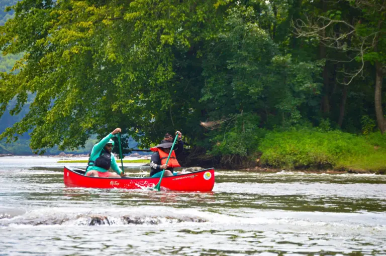
two men life jackets paddle a red canoe down the river.

About the Etowah River Water Trail

The river is mostly flatwater, rated Class I, with small shoals. Etowah Falls, a Class IV drop in the upper river, is the exception, and it’s for experienced paddlers only.

The Etowah is also unusually rich in history and wildlife:
  • It holds more Native American fish weirs than all other Georgia rivers combined.
  • It’s home to 76 native fish species.
  • Historic sites line its banks from Dawsonville to Rome, including the Etowah Indian Mounds State Historic Site.
  • It passes through three state wildlife management areas (Dawson Forest, McGraw Ford, and Allatoona), the Chattahoochee National Forest, and many local parks.


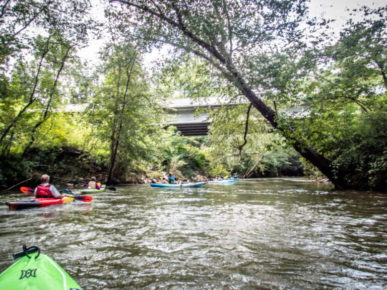
a group of kayakers on the Etowah River. Photo from https://www.randomconnections.com/chasing-gold-on-the-etowah-river/

What you’ll see along the trail

The Etowah changes character every few miles, from mountain forest to farm country to a city riverfront.

  • Dawson Forest: wild scenery as the river winds through national forest and wildlife management land.
  • Allatoona Dam: the dam creates Lake Allatoona, which covers about 12,010 acres.
  • Big Savannah and Reynolds Bend: quiet, rural stretches.
  • Gold-rush engineering: below Castleberry Bridge, miners hand-dug a tunnel to divert the river.
  • Mounds and heritage sites: the Etowah Indian Mounds State Historic Site and the Leake Mounds sits on the river.

Paddling above Allatoona

Above Lake Allatoona the Etowah is a free-flowing river of mostly easy water, with two serious hazards in the upper reaches. Launches here run from the Chattahoochee National Forest down to the lake, and most are informal, so plan where you’ll put in and take out before you go.

Upper river: Hightower to Dawsonville

This is the wildest and most challenging stretch. The uppermost access is Hightower Church Road in the Chattahoochee National Forest, and several bridge crossings below it have informal roadside access only.

  • Etowah Falls (about river mile 142): a Class IV drop of about 12 feet, roughly 4 miles below the GA 9 bridge in Lumpkin County. Scout it first. Portage on river right, and only with the landowner’s permission.
  • Mining tunnel: a Class II+ tunnel between Castleberry Bridge Road and GA 136, hand-dug by gold miners to divert the river. Only paddle through if you can see daylight all the way through, and watch for logjams below the exit. It’s on private land, so view it only from the water.
  • Amicalola Creek: the access at GA 53 is in Dawson Forest WMA and has an accessible fishing platform. A Georgia DNR license or Lands Pass is required for ages 16 and up. Downstream of it the water is Class III–IV+ whitewater for experts only.

Middle river: Dawsonville to Canton

Wildlife management areas and public parks make this stretch easier to reach. It’s mostly flatwater with small shoals.

Lower river: Canton to Lake Allatoona

Developed launches and an easy current make this the best stretch for beginners. The river gradually meets the lake at Knox Bridge.

Launches above Allatoona

River miles are measured upstream from the river’s mouth. Listed from upstream to downstream.

LaunchRiver mileNotes
Hightower Church Rd157–159Uppermost access, in the Chattahoochee National Forest
Jay Bridge Rd151Small pulloff, informal access
GA 52 bridge149Informal access, short trail to the water
GA 9 bridge, Lumpkin County146Informal access, put in under the south end of the bridge
Castleberry Bridge Rd140Informal access, take out on river right at or below the bridge
GA 136 bridge132Informal access, stay off private land
Dawson County River Park124Free stepped canoe launch on GA 9 south of Dawsonville
Kelly Bridge115Private fee access with a concrete ramp
Eagle’s Beak Park108Paddle launch, restroom, trails (Forsyth County)
Old Federal Rd108Road access just upstream of Eagle’s Beak Park
McGraw Ford WMA99Georgia DNR land; check DNR for access, passes, and hunting seasons
Long Swamp Creek Recreation Arean/aCanoe and kayak launch, restrooms, camping by permit
Gober Beachn/aInformal dirt lot, no facilities, sometimes gated
Etowah River Park, Canton78Canoe launch with steps, free parking, restrooms
Boling Park, Canton76Kayak launch, steep bank
Knox Bridge68Concrete ramp where the river meets the lake

Gober Beach is on East Cherokee Drive near Ball Ground, about 13 river miles above Etowah River Park. Park only where it’s legal. The lot can need four-wheel drive after rain.

Check the river before you go

Look at the live USGS gauges below GA 53 and at Canton before you leave. Levels change quickly, and the upper river is much more dangerous at high water.

Paddling below Allatoona Dam

Bartow County has about 36 miles of river and four public sites that open up 17 miles of it. Distances between launches:

LaunchNext stop
Leake Mounds, Cartersville1.3 mi to Floyd’s, or 8 mi to Euharlee Road
Floyd’s (private day-use area)7 mi to Euharlee Road
Euharlee Road, Euharlee9 mi to Neel’s Landing
Hardin Bridge, Kingston6 mi to Neel’s Landing
Neel’s Landing, Kingston16 mi to Dixon Park Landing (Grizzard Park), Rome

Paddling takes longer than you’d expect when the current is slow, so plan your trip with extra time.

Plan your trip safely

  • Paddle only in daylight.
  • Check river levels before you go. Each launch on the map has a link when a USGS gauge is nearby.
  • Respect private property and don’t trespass. Use the public access points.
  • Allow extra time. A slow current can add hours to a trip.

Rentals and outfitters

Outfitters along the trail include Appalachian Outfitters (Dahlonega), The Outside World (Dawsonville), Euharlee Creek Outfitters (Euharlee), and the Coosa River Basin Initiative (Rome).

Who looks after the trail?

The Etowah River Water Trail Stakeholders Group coordinates the trail. It’s a mix of local governments, nonprofits, businesses, and individuals. The group installs kiosks and maps at access points, puts up road signs to launches, and helps local governments build new ones. The trail is part of the Georgia Water Trail Network. Partners include Bartow, Forsyth, Cherokee, Dawson, and Floyd counties, and the cities of Canton, Cartersville, Euharlee, and Rome. They also include the Coosa River Basin Initiative, the Upper Etowah River Alliance, and the Georgia Canoeing Association.

Want to help protect the river? Join the Upper Etowah River Alliance.

How to Help the Etowah

  • Become a Member

    Join our community of members who are committed to protecting the Etowah River.

  • Volunteer

    Join us on the water and along the shore through hands-on volunteer opportunities that directly protect and restore our local watershed.

  • Report a Problem

    If you see something, say something. Let us know if you see a possible water quality problem.

  • Stay Informed

    Sign up to our newsletter and receive our emails, event information, and updates.
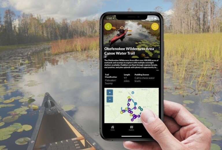
A hand holds a phone showing the Okefenokee Wilderness Canoe Trail in the Georgia River Guide app, in front of a canoe on a lily-pad swamp

Georgia River Guide

You can explore the Etowah River Water Trail using the free Georgia River Guide mobile app developed by Georgia Rivers. The Georgia River Guide App offers real-time data, trail mapping, local resources, and more! 

Download the App

Join the River Community

Stay up to date on all our work by connecting with us on social media.