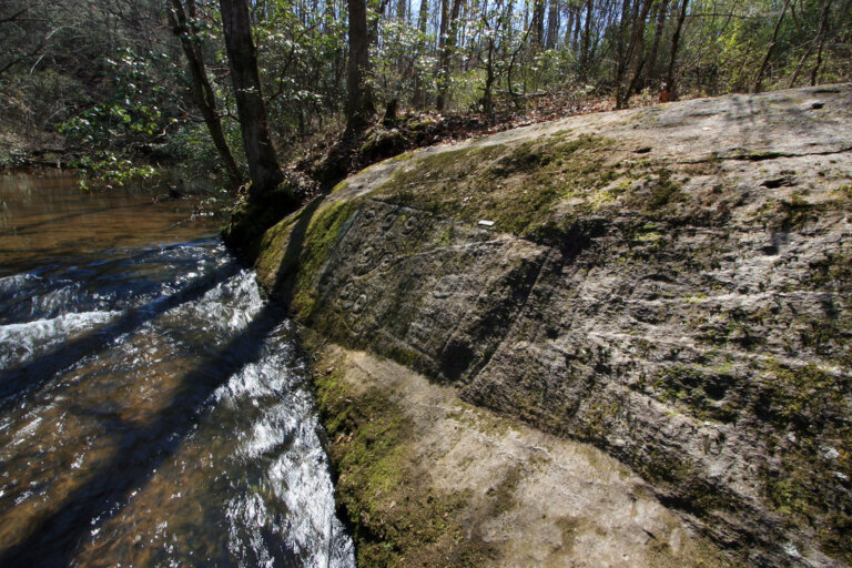
On a rock face just above a creek in Cherokee County, someone long ago pecked three boxes, rows of circles, and a line of footprints that seem to walk out of the stream. People pecked those marks into the stone long before Georgia was a state. A study published in August 2025 asks a simple question about them: why did they put them there?
The answer, according to archaeologist Johannes Loubser, is water. The study, “We Begin in Water, and We Return to Water”, pulls together three decades of recording petroglyphs (carvings pecked into rock) at 23 sites in north Georgia and western North Carolina. Loubser calls this group of sites the Track Rock Tradition, after Track Rock Gap in Union County. Six of the 23 sites are in the Upper Etowah watershed.
What Is the Track Rock Tradition?
These carvings were made over about 3,800 years, and Loubser sorts them into ten kinds of marks. The oldest are small cup-shaped hollows called cupules and wavy lines called meanders, which are more than 3,000 years old. Later artists added footprints, handprints, and figures (the Woodland period, roughly 3,000 to 1,050 years ago), then circles inside circles (Early Mississippian, roughly 1,050 to 600 years ago), then crosses in circles and spirals. The most recent marks were cut with metal tools after Europeans arrived.
Because the carvings fall inside the old Cherokee homeland, Loubser reads them through Cherokee beliefs, adding Muscogee (Creek) traditions where the evidence points that way. These are his interpretations. Other scholars may see things differently, and for the six sites in our corner of the watershed, he notes that almost no recorded Native testimony about the carvings has survived.
Why Water?
Nearly all of these carvings sit close to water, from soggy seeps and springs to creeks and rivers. Loubser points to two reasons.
- Water helped make them. Based on his own work removing graffiti from petroglyph rocks, he argues that carvers almost certainly used water to peck, scrape, and cut hard stone, because water carries the loose rock grit that does the cutting.
- Water connected two worlds. In Cherokee tradition a river is Long Man, a living being with his head in the mountains and his feet in the floodplains. People went to the water to pray, purify, and prepare for big moments in life, and the study argues that the carvings marked places where that connection felt strongest.
Shoal Creek Rock
One of the six Upper Etowah sites is on Shoal Creek, one of the largest streams feeding Lake Allatoona. Loubser describes it as an outlier, a site that stands apart from the rest of the tradition. Here is what he found:
- A panel with three boxes side by side. One holds nine circles, each around a small hollow, and another is a box inside a box. Nothing quite like it turns up elsewhere in the tradition.
- The panel sits only about four inches above the creek’s normal level. After heavy rain, the creek rises and covers it completely.
- A vertical line of six weathered footprints, about two meters away, that looks like a trail of steps coming out of the creek. They are probably older than the boxes.
The rock has been surprising people for a long time. Amateur archaeologist Margaret Perryman first described it to other rock-art researchers in 1961, when it was also known as Mystery Rock or Indian Rock. In the 1980s, a visitor noticed two footprints. When Loubser and that visitor came back in 2001, rainwater pooled in the pecked toes and heels, and the right angle of light made another three show up, for five in all. The latest study counts six. Carvings like these can hide in plain sight until the light, the weather, and the water line up.

Loubser suggests the boxes may picture a Creek townhouse, a community gathering place, and that they may be 600 to 1,050 years old, like the circle designs on pottery from nearby Etowah Mounds. He is careful to say this is his reading, not a settled fact. Another reviewer of his paper even suggested the panel could be a map of the spirit world. Nobody knows for sure what it means.
The study also notes that the Etowah itself begins at Amicalola Falls and Black Mountain, and Loubser ends with a question: could Long Man, with his head in the mountains and his feet in the Etowah floodplain, tie together every river valley and carved rock in between?
Why UERA Cares
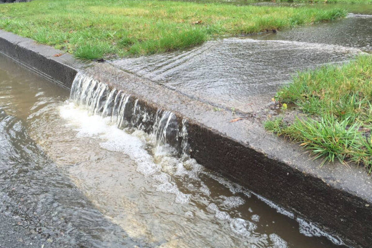
We usually talk about creeks in terms of bacteria counts, fish, and drinking water. This study is a reminder that these streams have mattered to people for thousands of years, for reasons that go well beyond the science. The lower 15.5 miles of Shoal Creek don’t currently meet state water quality standards because of high E. coli bacteria, according to Georgia EPD. Clean, steady streams are part of keeping these places the way they’ve always been, and they are something we can still protect.
Want to meet the creek behind the story? Read about Shoal Creek and the other waterways of the Upper Etowah.
Protecting Rock Art
Rock art can’t be replaced. Loubser has worked with tribal historic preservation offices to remove deeply carved graffiti from petroglyph rocks, which shows how much damage careless visitors can do. We aren’t sharing where Shoal Creek Rock is, and we ask you not to go looking. If you ever come across carvings on your own, please:
- Look, take photos, and leave. Don’t touch, trace, chalk, scrub, or add to them.
- Skip posting the location online.
- Tell the landowner or land manager, and the Georgia state archaeologist, if you see damage.
How You Can Help
- Protect our streams. Have your septic system pumped and inspected, pick up after pets, and keep livestock out of creeks.
- Spot a problem? Report it to us. For spills and fish kills, call the GA EPD 24-hour line at (800) 241-4113.
- Get your feet wet. Join our water monitoring volunteers or sign up to volunteer.
- Support the work. Become a member or make a gift to keep the Upper Etowah clean for the next thousand years.
Sources
- Loubser, Johannes H. 2025. “We Begin in Water, and We Return to Water”: Track Rock Tradition Petroglyphs of Northern Georgia and Western North Carolina. Arts 14(4):89. Open access (CC BY).
- Loubser, Johannes. 2001. “Shoal Creek/Mystery Rock Revisited.” ESRARA Newsletter 6(2):12–13. Eastern States Rock Art Research Association.
- Georgia Environmental Protection Division. 2024 list of streams not meeting water quality standards.